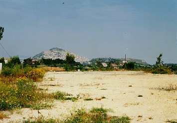
This photo is taken from the west of the town about one half way from Nissoria towards Agira and just to the south of highway 121. The town occupies the crest of the hill in the distance just to the left of the center of the photograph. Highway 121 was the central axis of the Canadian Army advance to capture the town, which it did on 28 July, 1943. The high ground to the right of center was an additional impediment to the advance. This ground was the scene of contested fighting from 25 through 28 July as the Canadian advance was held up and tactics changed from a "fire and movement" approach to a set piece advance under artillery barrage.