On the outskirts of Wiaouru -- our first view of the three giants, Riapehu,
Ngauruhoe/Tongariro and Pihanga (note the ever present
sheep in the field in the lower foreground). These volcanoes were to dominate our
visit to the area for a couple of days and to fully appreciate some of the pictures
it is important to know the scientific description of their origins:
"The great mountains in the heart of the North Island were once Gods and
Warriors of great strength. To the north west of Tauhara stood Pihanga whose fame and beaurty was widely known.
Each of the four mountains, Mount Egmont(Teranaki), Mount Ngauruhoe ,
Mount Tauhara and Mount Edgecumbe or Putauaki (Bay of Plenty) wooed her and wished her to be his wife.
Pihanga adored them all.
They responded with joy and majestic outbursts and covered the earth with fiery lava and molten stones
Pihanga could not decide which one she would marry.
Puhanga aroused the passions of the giants -- she made the great giants, the volcanoes, tremble! They became silent, gathering strength. The rumblings grew into a crashing thunder and Tongariro erupted a fiery mass of molten stones. The battle had started and raged for many days and nights. Tongariro emerged victorious. He became the Supreme Lord over the land and the proud husband of Pihanga.
The defeated mountains decided to leave and find domains where they could rule undisturbed.
Mount Egmont followed the setting sun to Taranaki and got there by following the winding path of the Whanganui River. Tauhara and Mount Edgecumbe decided to travel towards the sea and look towards the dawn. They had to complete their journey in one night. Tauhara moved very slowly as he was sad and sore and only got as far as the north eastern shore of Lake Taupo and looks broodingly across at Pihanga and her proud husband. Mt Edgecumbe moved quickly northwards and wehn the morning sun rose he found himself at the northern end of the Kaiangaroa Plains -- 160 kilometers from where he originally stood.
One day, perhaps they will rise up to return to the realms of Tongariro to seek revenge. Who knows?"
In the photograph the gods are, from left to right, Ruapehu, Ngauruhoe which obscures Tongariro from this angle, and Pihanga, just barely visible.
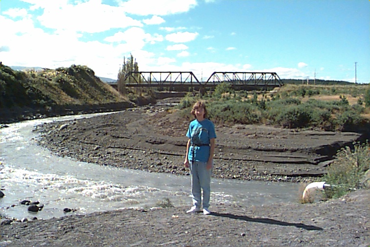
We next stopped at a river just a few kilometers outside Wiaouro -- scene of a tragic train crash on Christmas eve 1953 -- Christine stands on the banks of the river with the rebuilt railway bridge in the background. About every 50 years or so an icejam on the mountain will suddenly break sending a flood of water down the river. This happened on Christmas eve just before the express train from Auckland to Wellington appeared. It plunged into the river because of a weakened bridge, killing 151 people. We stopped for a few minutes at the memorial. The banks of the river are particularly black as a result of the recent eruptions of Ruapehu.
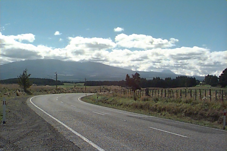
We followed highway 49 along the south edge of Rangataua Forest which is on the lower slopes of Ruahape for a distance of 27 kilometers to the town of Ohakune. The road, as with all the roads around volcanoes passes over many rivers which radiate out from the peak. The road itself is fairly winding, but at all times on the right was the dominating image of Ruapehu.
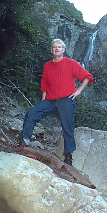
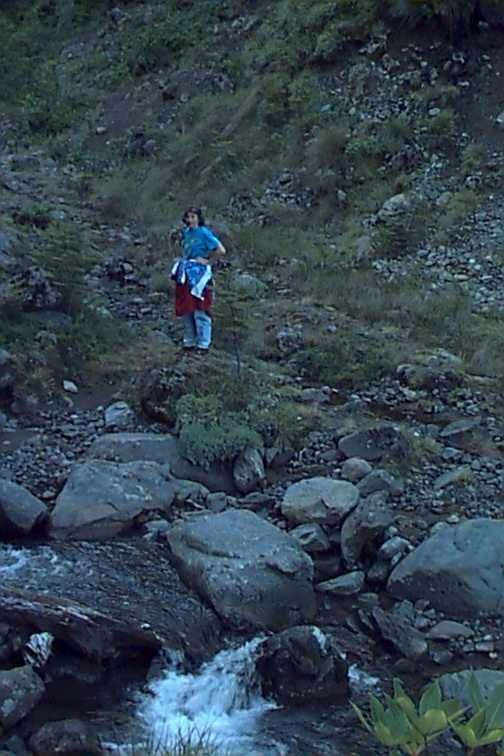
By this time it was mid-afternoon. We decided against a climb up to the peak, and instead opted for an hour stroll to a waterfall on the lower slopes. As with all strolls in New Zealand, this necessitated climbing a few hundred meters on a mountain trail. The photos show Ken and Christine at the foot of the falls.
On the top of the hill that we climbed over to see the waterfall was a piece of terrain which was very much like muskeg. It was a licken and moss bog area and to provide a trail over the terrain a raised wooden walkway had been built. This walkway, an alpine pond, and a well dressed tramper are captured in this photo.
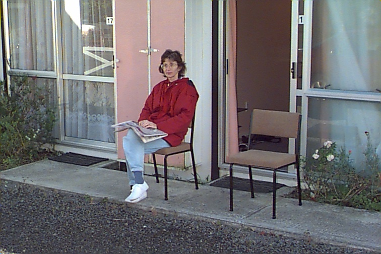
We returned down the mountain and spent the night in Ohakune. We had a nice meal in a restaurant for about $40 including wine, and spent the night at the Ohakune Mountain View Motel. The room which was self contained and had tea and coffee making facilities was $60 for the night.
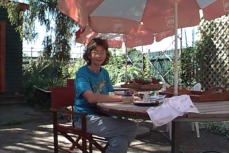
In the morning (luckily the volcano did not erupt in the night and obliterate the town) Christine caught up on the world news.
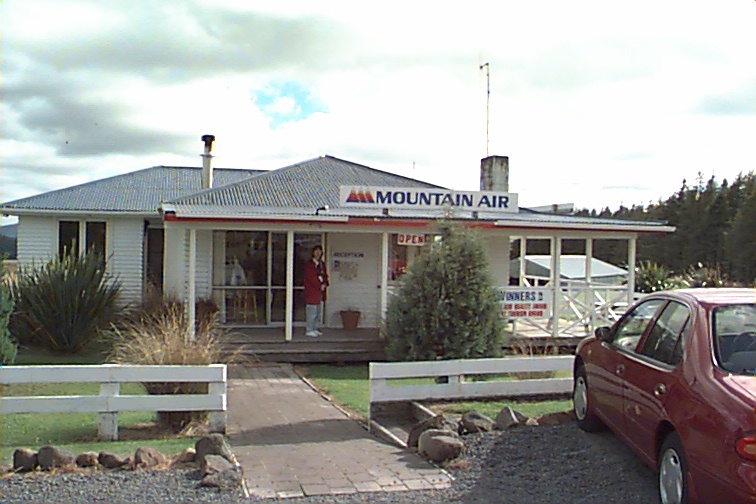
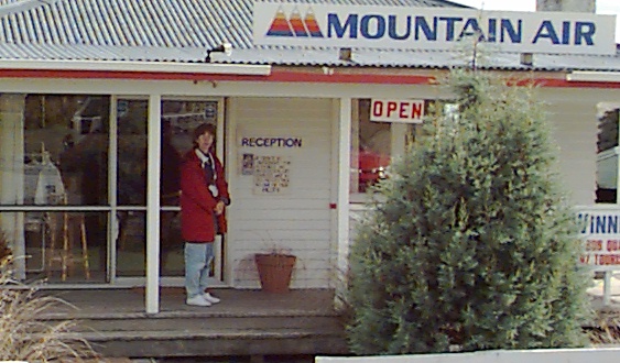
However, more striking to us at this intersection was Mountain Air, a small airport and airline that specializes in flights over the volcanoes. We were hooked. For a cost of $110 each we were given a 40 minute ride over Tongariro (1968 meters), Ngauruhoe (2291 m.) and Ruapehu (2797 m.).
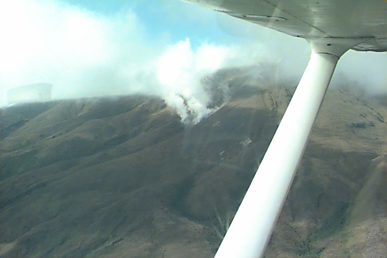
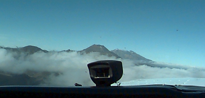
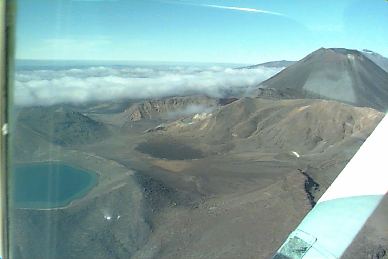
The flight was made in a climbing fashion starting first with the lowest and northernmost volcano, Tongariro. On the north side of this mountain (at about 11 o'clock position)are the dramatic Ketetahi Springs area which generate large clouds of steam. In this photo we are still below the clouds. As we climbed we moved around the mountain to about the two o'clock position and, now over the clouds had a fabulous view of the Blue Lake, a flooded crater on the top of the mountain. By now we had enough altitude to see, looking south, the summits of all three volcanoes over the console of the aircraft (a Cesna 172). This view alone made the trip worthwhile. We continued to climb and next saw the Emerald Lakes, one of which appears in this photo, with the perfect cone shape of Ngauruhoe in the background. Next we see, in a superb alignment, the red crater of Tongariro, with the Emerald Lakes in the foreground, the cone of Ngauruhoe behind, and in the left background the start of the slope of Ruapehu.
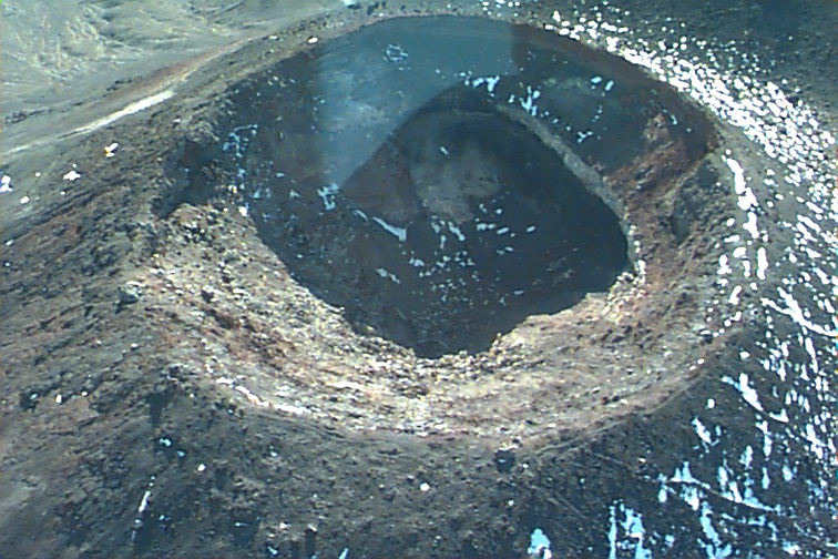
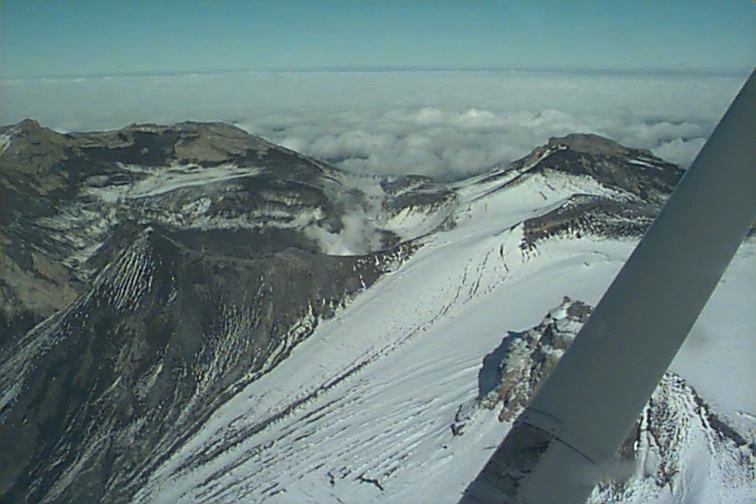
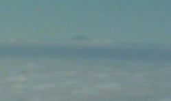
Next we climbed above Ngauruhoe and circling from the south obtained this lovely shot down into the cone of the mountain. The shot is clearly taken from the south as the shadows indicate since the sun is in the north. Continuing our climb and coming further south we arrived at our destination above Ruapehu. Higher than the other volcanoes it is snow covered year round, however, the mountan has a steam emitting poolwhich, clearly visible in this photo can be seen from many kilometers away. Higher yet, and closer, we can see the blue lake with its steam emmission. Also visible in this photo is the black ash that has spewed from the volcanoe in the last year.The lake is also warmer now than normal because of the eruptions. This completed the major portion of the flight, and it was left now only to descend back to the airport. But look, there on the western horizon, just barely visible above the clouds and in the haze of the distance, is the cone of Teranaki which we had visited on Feb 21! A perfect ending to a flight we will never forget.
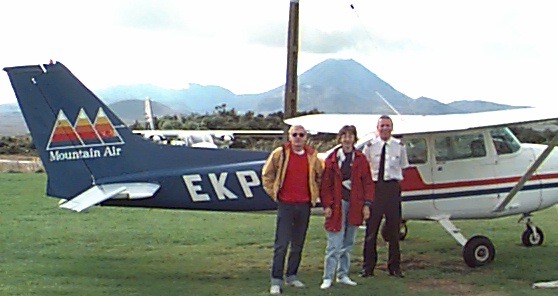
Back on the ground there was time for a picture with pilot Paul Dawson, his Cesna, and the ever present Ngaurohoe in the background. If you are ever in the area be sure to take this flight. Paul's running commentary during the flight, as well as the notes provided by Mountain Air have made it possible to provide this description of the flight -- my thanks to them. And so, farewell to Mountain Air